New Pending Plans & Projects
District History
& Background
Generally bound by SH 249 (N), TC Jester Blvd (E), Pinemont Dr (S), and Hollister Rd (W).
Created in 2001 by the state Texas Legislature to address concerns about public safety and economic decline by promoting and coordinating the economic growth, cultural activities, and the public welfare of property within its boundaries.
Programs include public safety, branding, graffiti and litter abatement, economic development, and public infrastructure.

District Initiatives
West Little York Pedestrian-Transit Improvements
Project Scope:
Details:
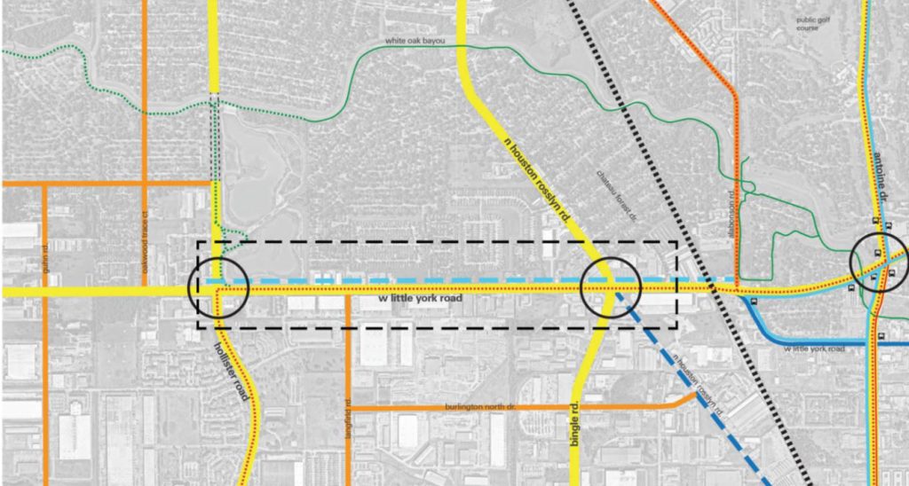
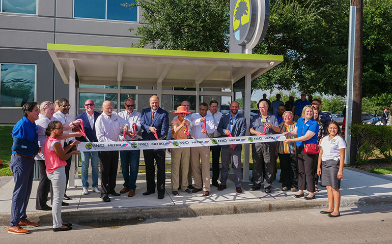
Shelters Supporting Extended Route
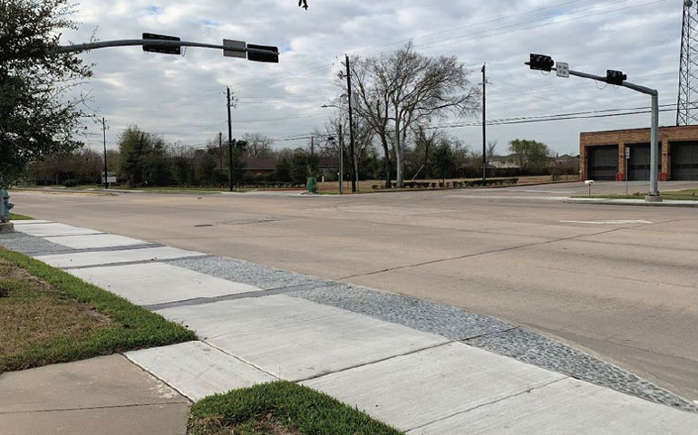
New Sidewalks
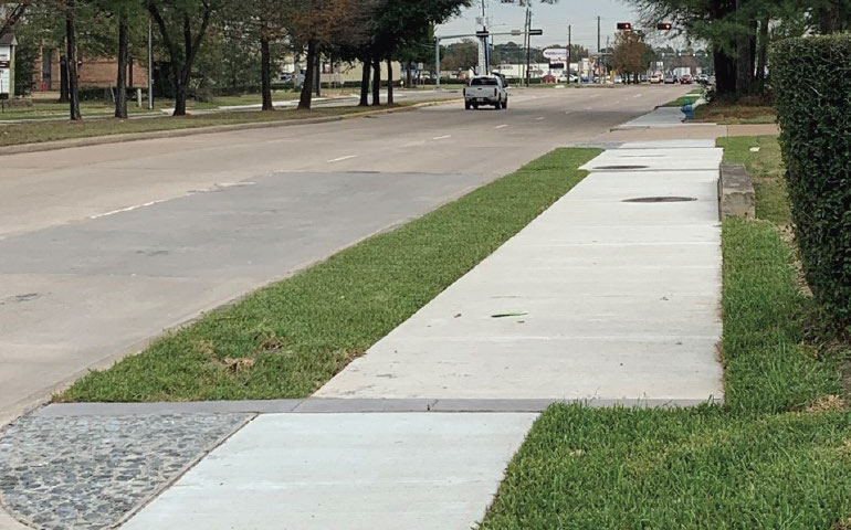
New Sidewalks
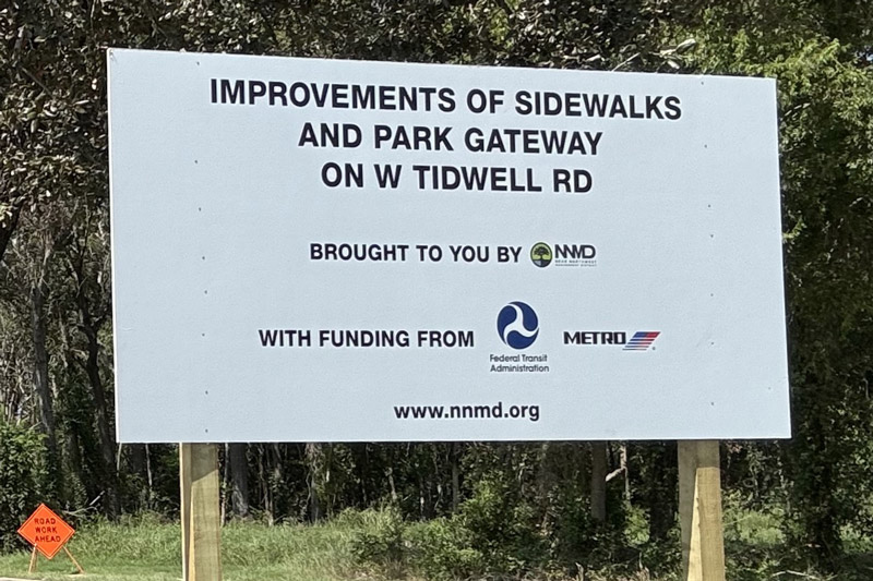
West Tidwell Road Pedestrian-Transit Improvements
Project Scope:
Details:
Project Updates:
W Tidwell Project Updates – Sept 19, 2024
Our project signs have been installed at both ends of the project. The construction crew has demo’d from the White Oak Bayou bridge to Ash Creek and poured new sidewalks. They will be […]
W Tidwell Project Updates – Aug 28, 2024
The project kicked off on August 6th with demolition of existing sidewalks on the…
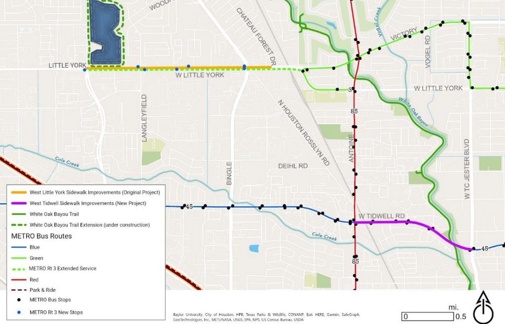
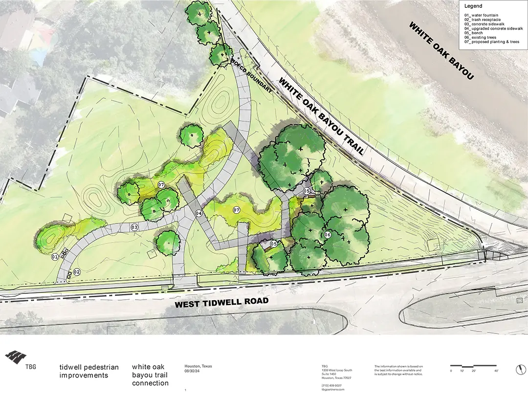
Project Plan View Schematic Layout

West Tidwell Road Trailhead – Draft Concept Example
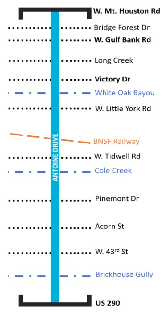
Antoine Drive Reconstruction
Project Background:
Project Limits:
Scope
Benefits
NNMD Boundary
For details and to sign up for updates, check the City’s project page at Antoine: US 290 to West Mount Houston | Engage Houston.
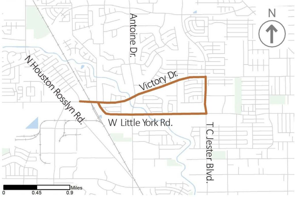
W Little York/ Victory DR/ T C Jester BLVD (Safe Routes to School)
Existing Conditions
Proposed Improvements
Monetized Benefits
Next Steps
Project Map
Proposed Plan View Schematic Layout (NTS
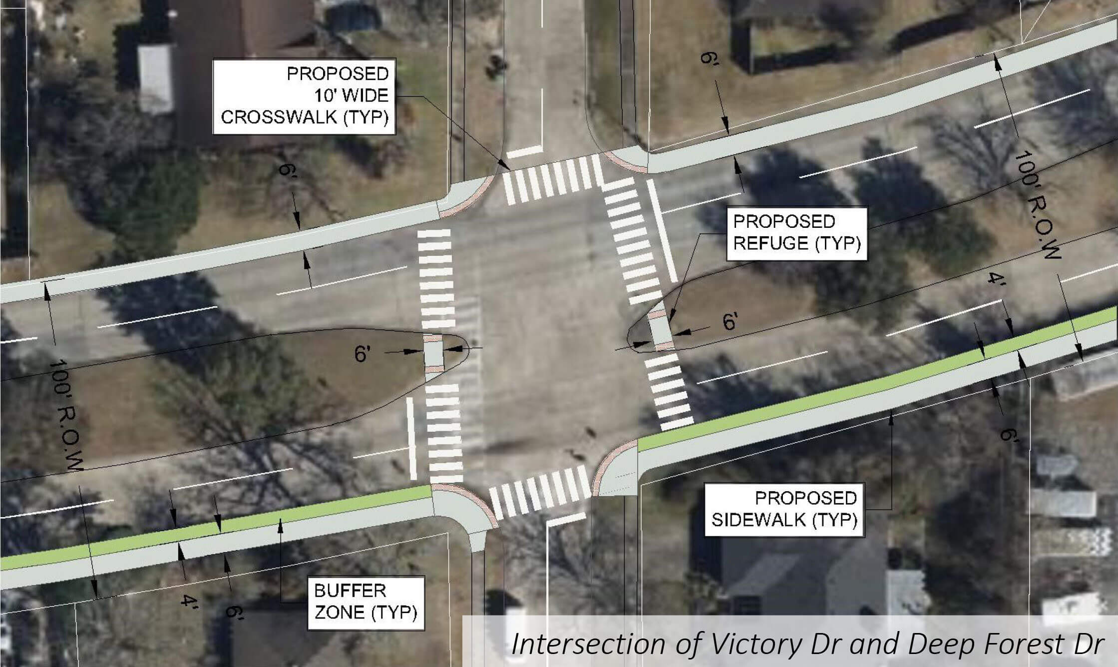
Site Context
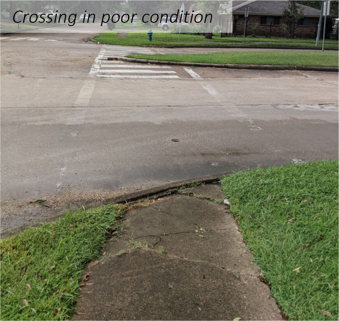
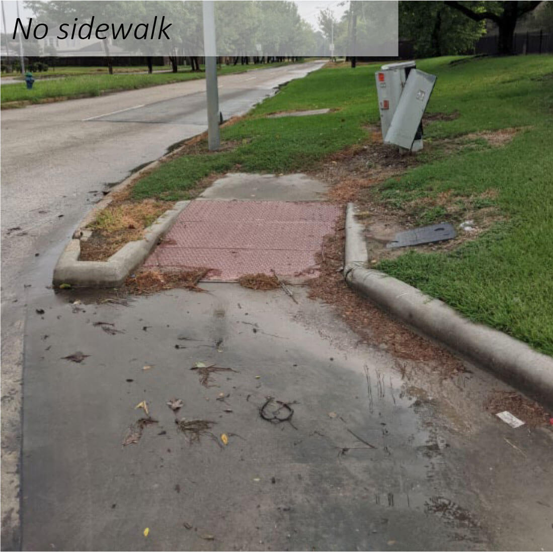
Site Context
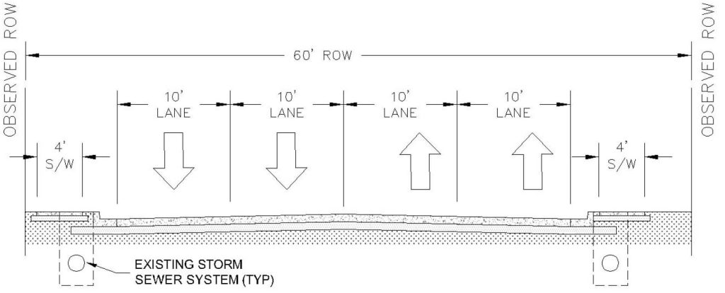
Observed West Little York Cross Sections (NTS)
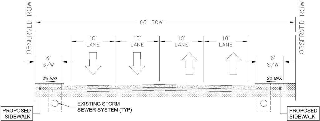
Proposed West Little York Cross Sections (NTS)
Intersection Safety Program
Existing Conditions
Proposed Improvements
Next Steps
Project Map
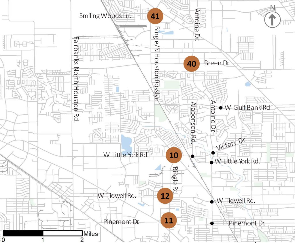
| Intersection ID | Intersection Name |
|---|---|
| 10 | W Little York Rd & N Houston Rosslyn Rd |
| 11 | Bingle Rd & Pinemont Dr |
| 12 | Bingle Rd & W Tidwell Rd |
| 40 | Antoine Dr & Breen Rd |
| 41 | N Houston Rosslyn Rd & Smiling Woods Ln |
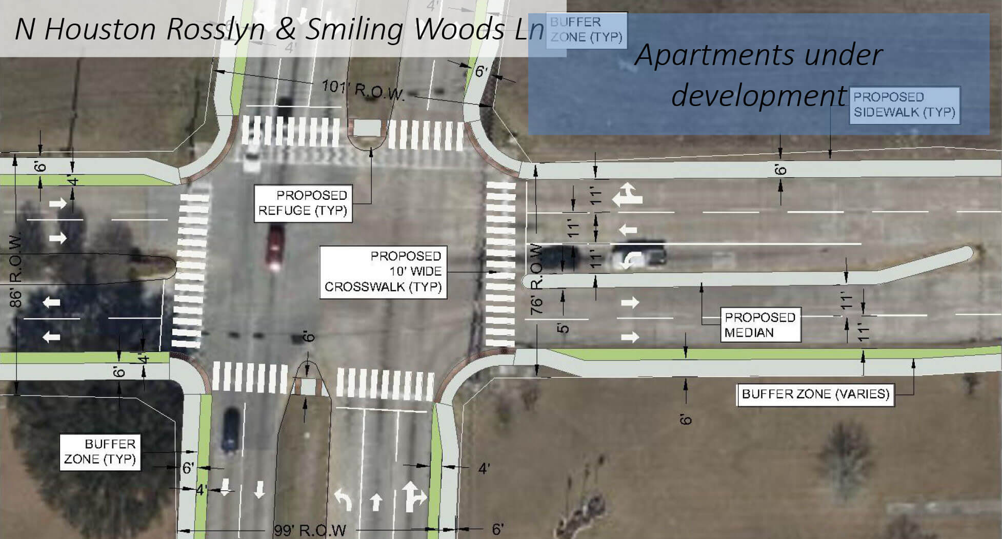
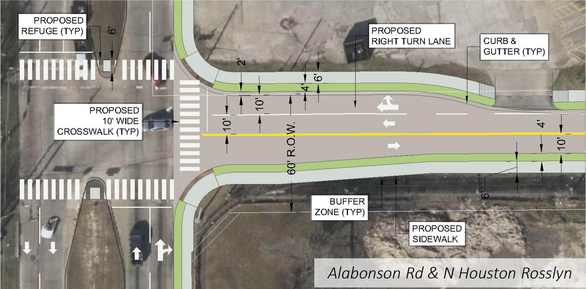
Proposed Plan View Schematic Layout (NTS)
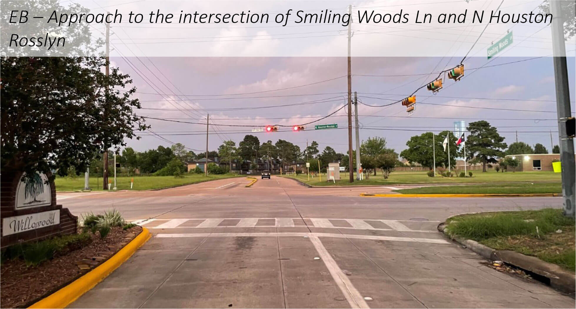
Site Context
Rosslyn
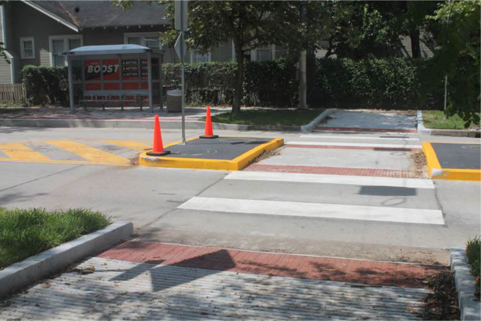
Pedestrian Refuge Island Example
Alabonson Road Reconstruction Project
Existing Conditions
Proposed Improvements
Monetized Benefits
Next Steps
Project Updates:
Alabonson Road Reconstruction Project Public Engagement Summary
Through an assessment and community concerns feedback, the Near Northwest Management District identified Alabonson Road as a corridor in poor condition with high documented crash rates, nonexistent or poor condition sidewalks and no […]
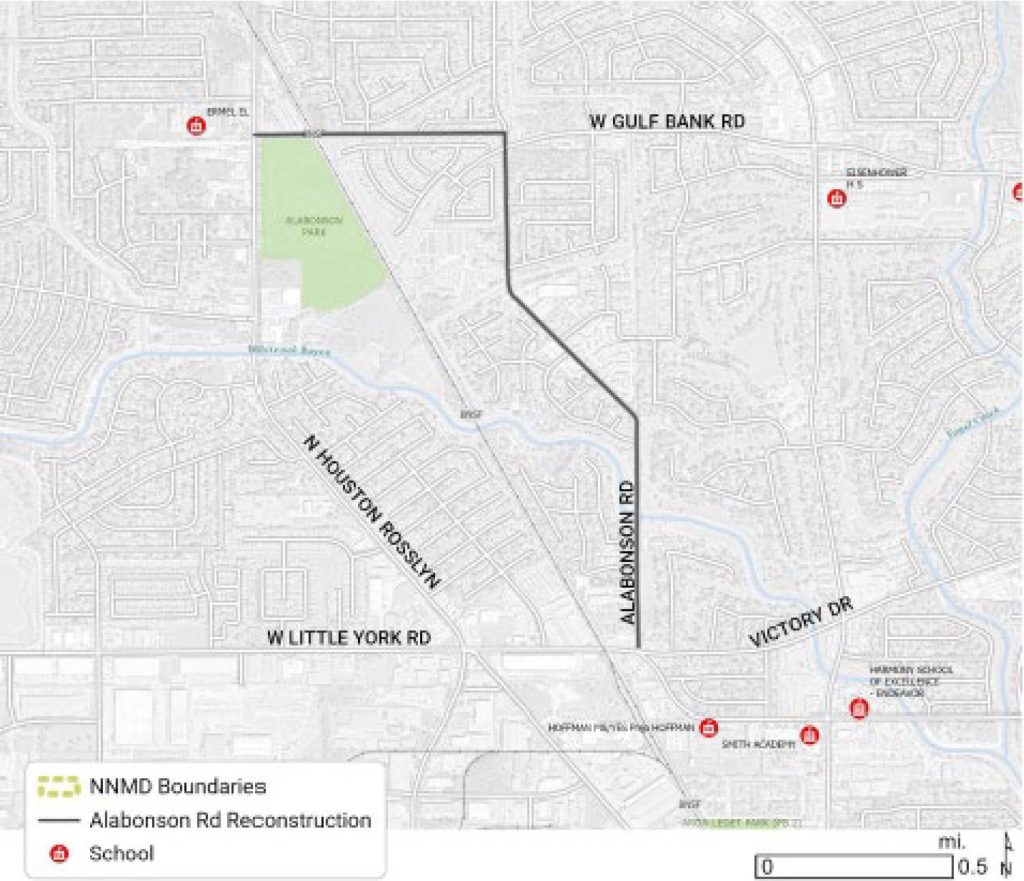
Project Map
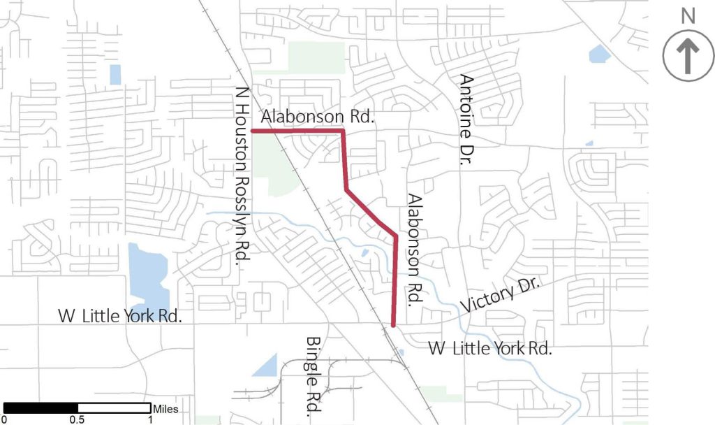
Proposed Plan View Layout (NTS)
Site Context
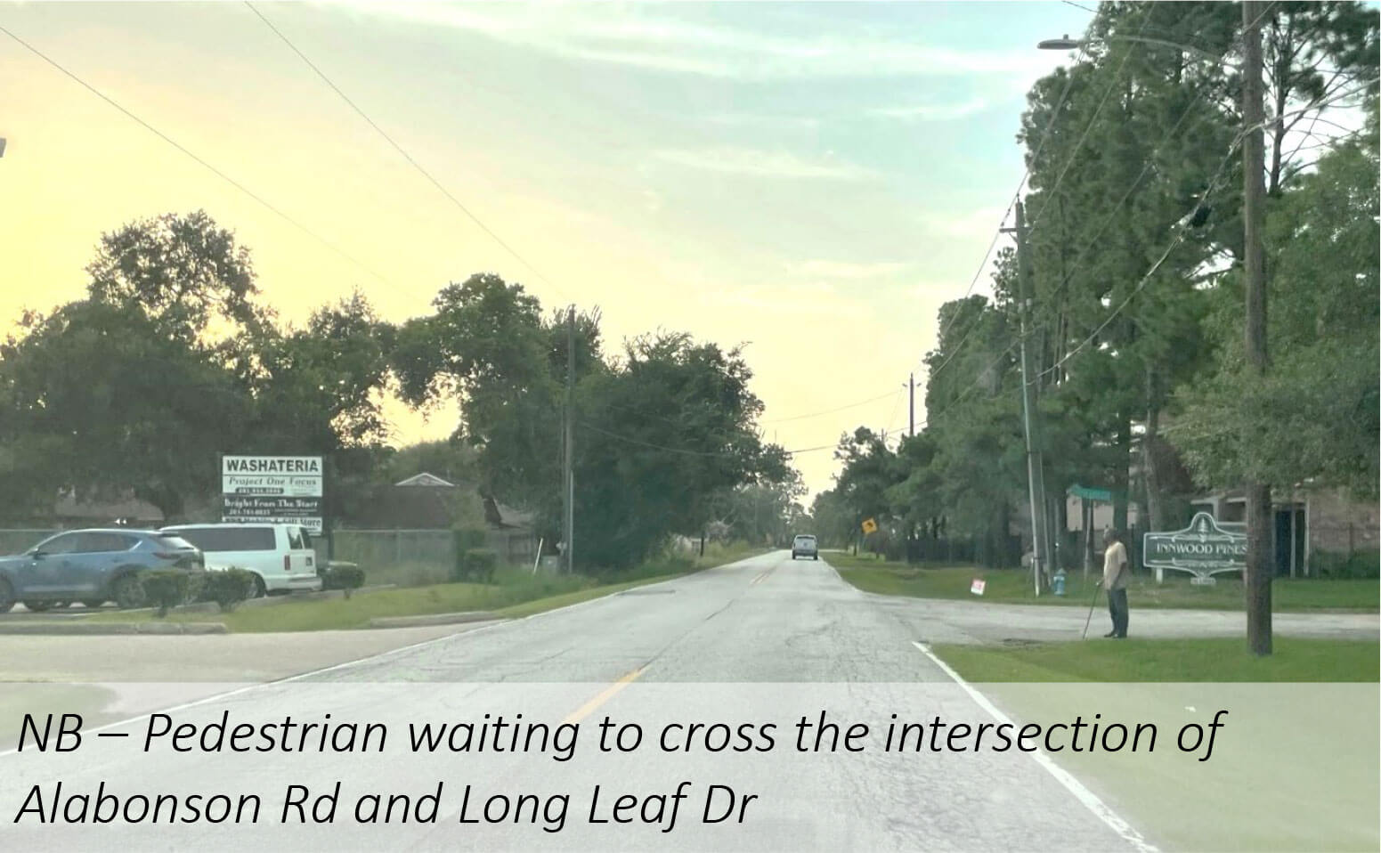
Site Context
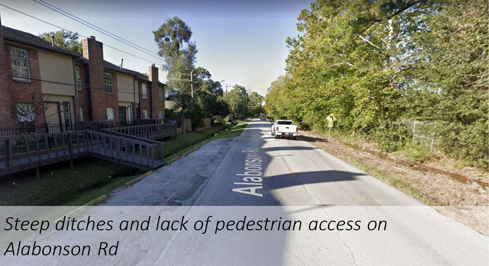
Alabonson Rd
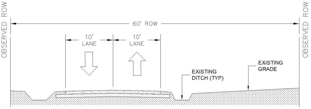
Observed Alabonson Road Cross Sections (NTS)
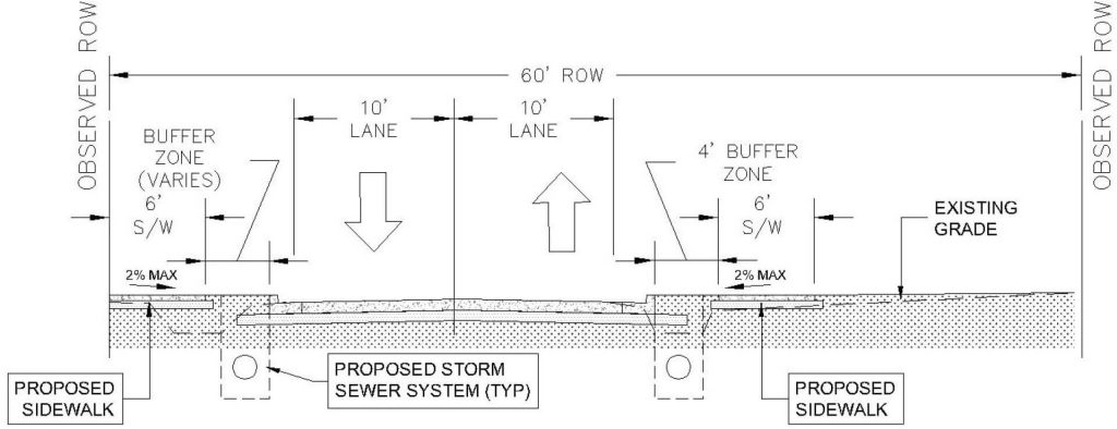
Proposed Alabonson Road Cross Sections (NTS)
Adjacent Schools
HCFCD / COH Inwood Forest Project
Breen Drive Reconstruction Project
Existing Conditions
Proposed Improvements
Monetized Benefits
Next Steps
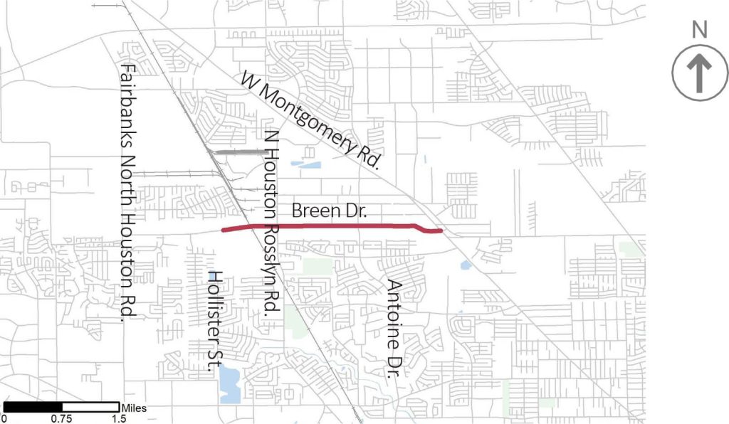
Project Map
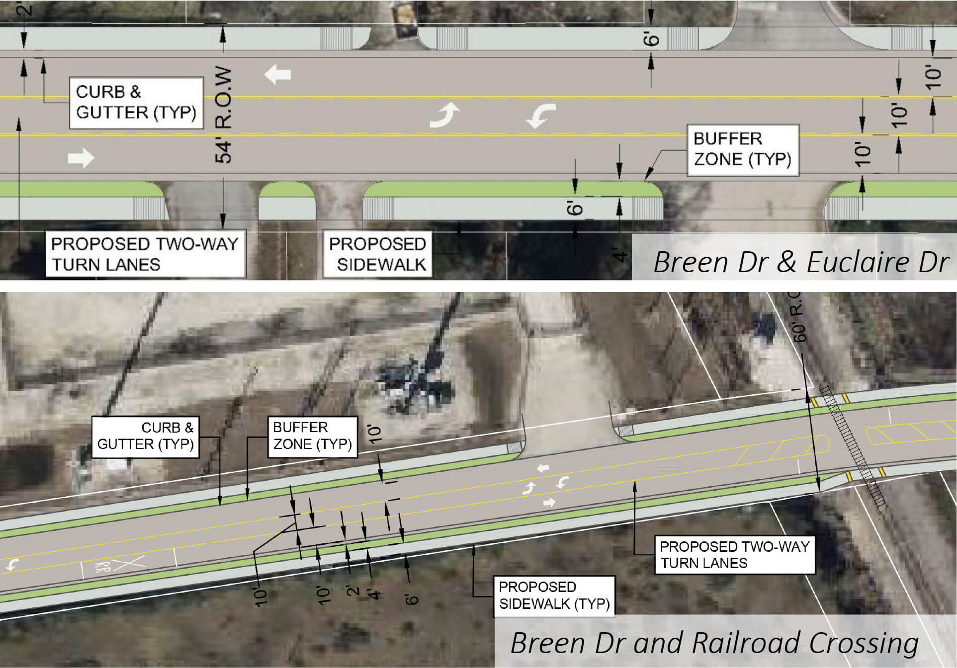
Proposed Plan View Layout (NTS)
Site Context
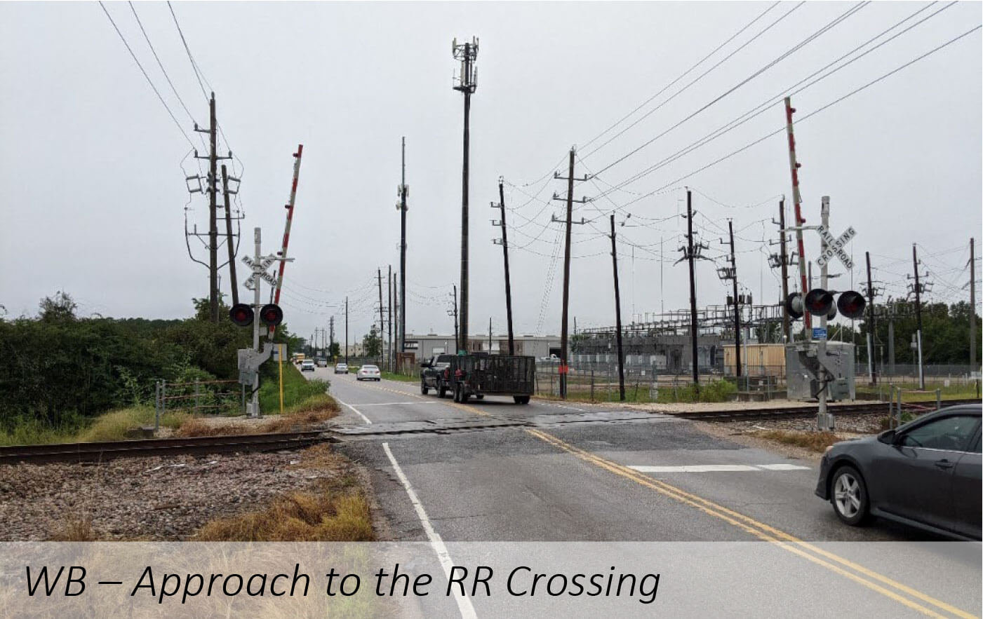
Site Context

and Breen Dr
Observed Breen Drive Cross Sections (NTS)
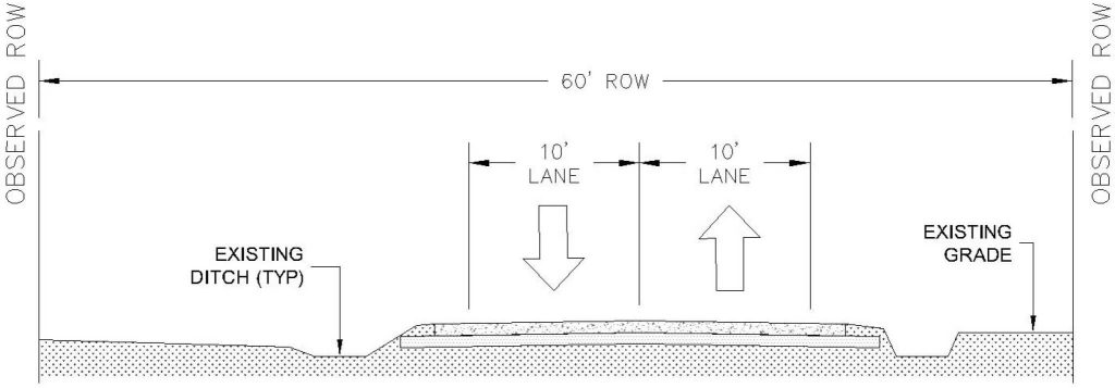
Proposed Alabonson Road Cross Sections (NTS)
De Soto Street Bike-Pedestrian Access Project
Existing Conditions
Proposed Improvements
Monetized Benefits
Next Steps
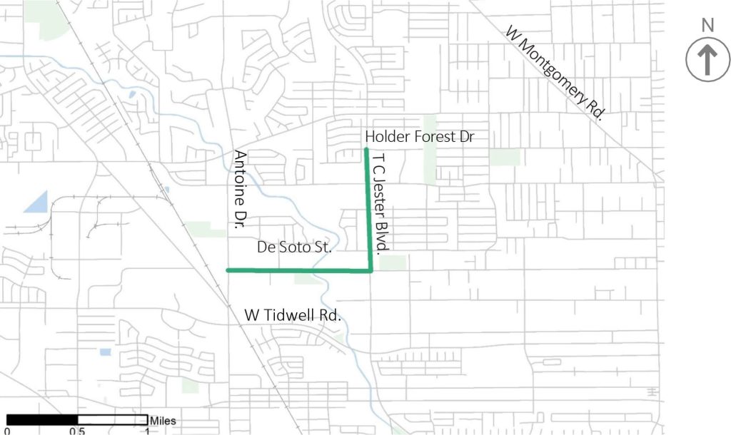
Project Map
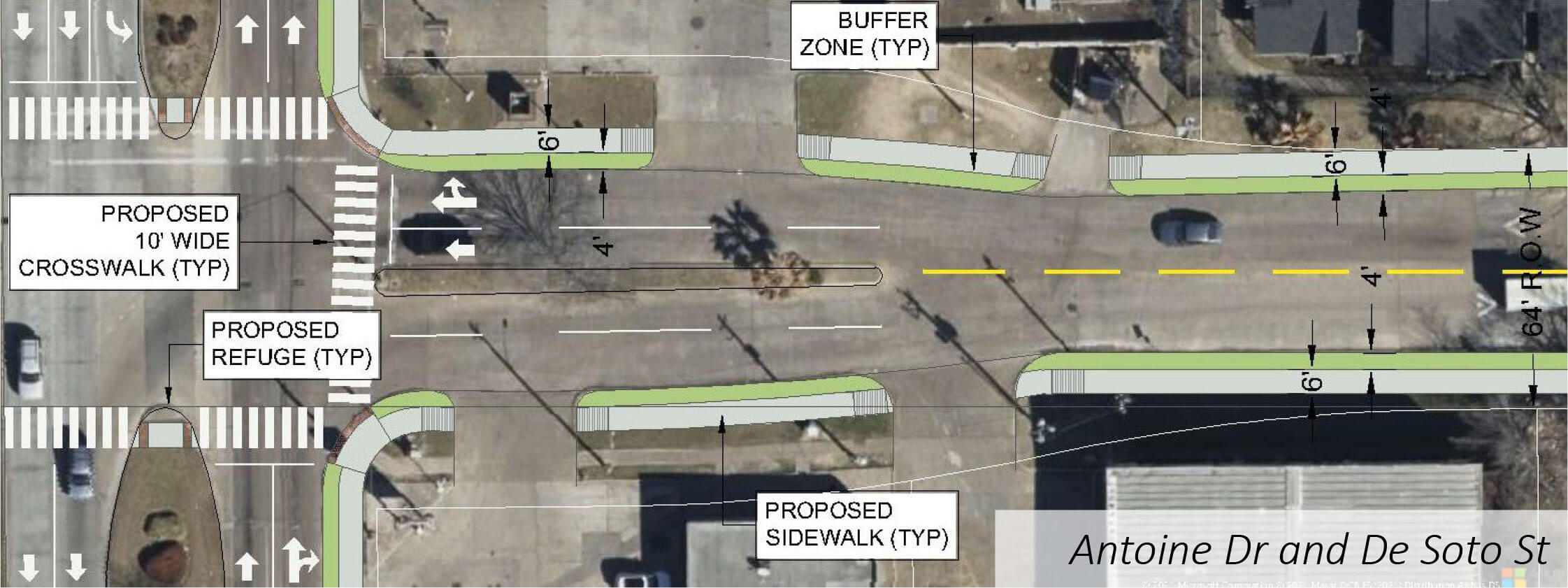
Proposed Plan View Layout (NTS)
Site Context
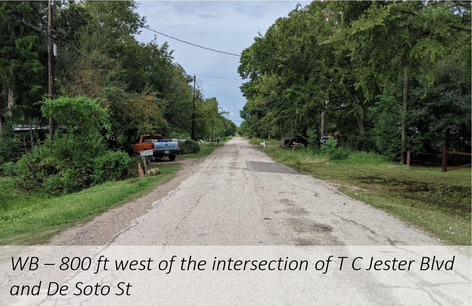
Site Context
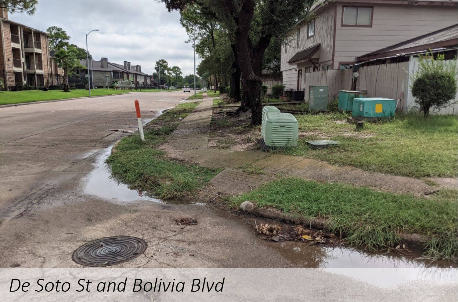
Observed De Soto St Cross Sections (NTS)

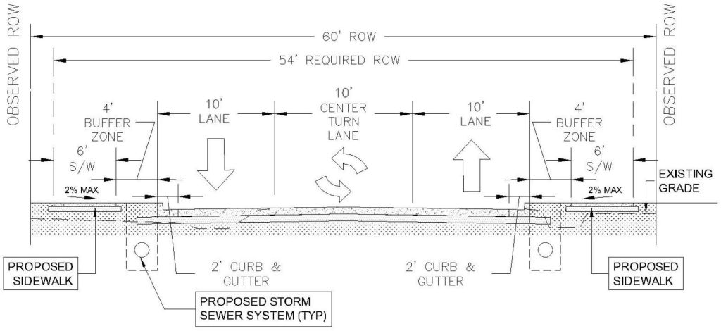
Proposed De Soto St Cross Sections (NTS)


